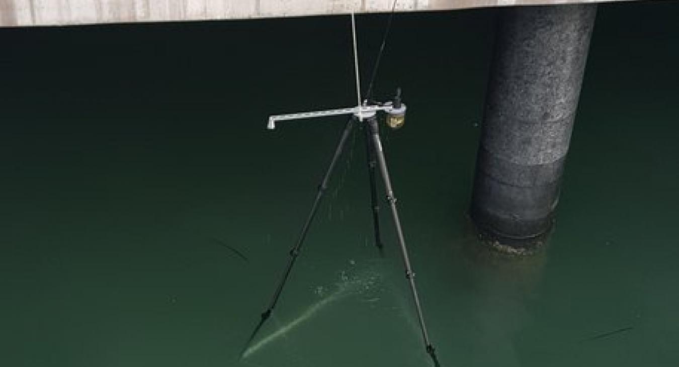
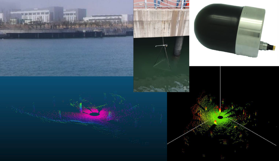
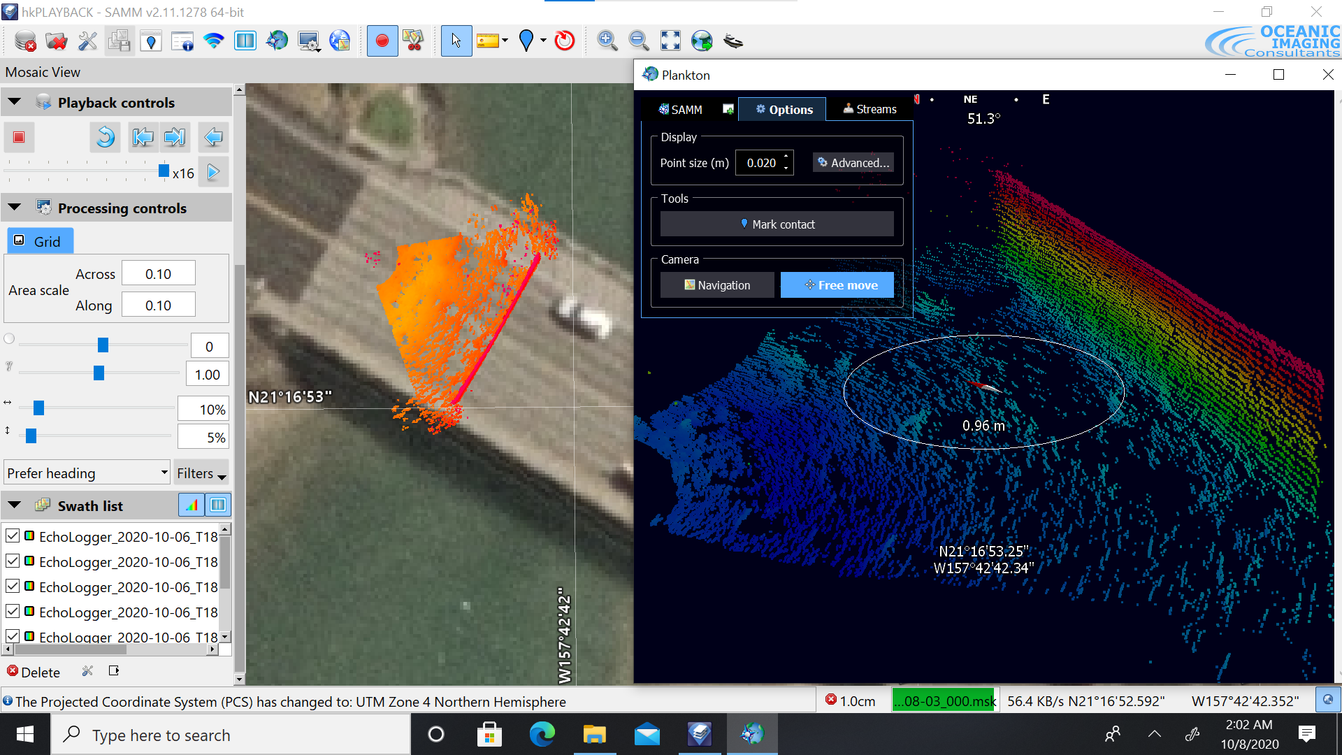
High resolution 3D sonar scanning for underwater strucutre / scour monitoring
We offer open-source APIs for our devices, empowering developers by simplifying integration, accelerating development, improving functionality, and enhancing compatibility. This strategic move not only boosts developer satisfaction and productivity but also strengthens our market position and drives innovation.
Echologger APIs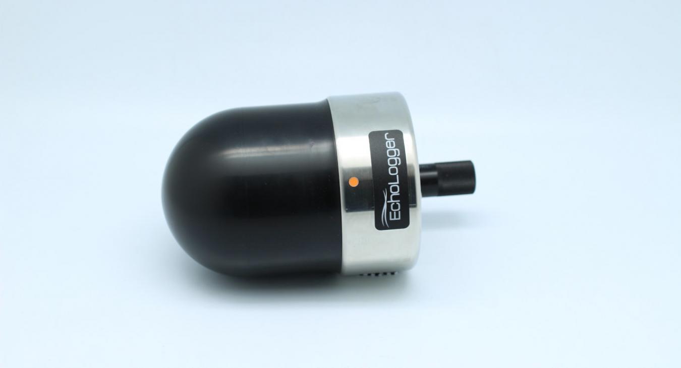


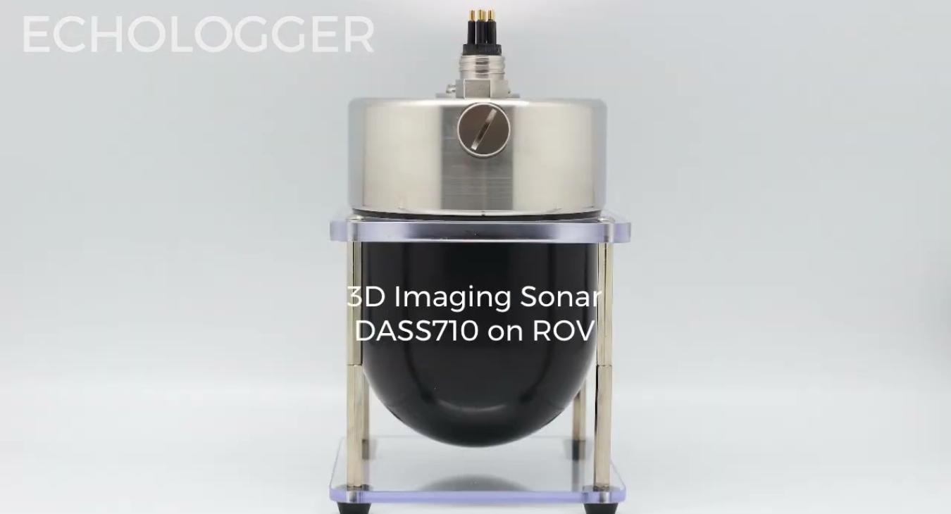
The DASS710 is an ultra-compact 3D scanning sonar that combines powerful scanning capabilities in a compact form, providing versatility for efficient underwater exploration. It is equipped with high-resolution pencil beams from a broadband composite transducer, ensuring detailed and accurate imaging of the underwater environment. Users can choose between a full 360° horizontal scan or a customized sector scan (200° vertical) for flexibility in adapting to specific survey requirements.
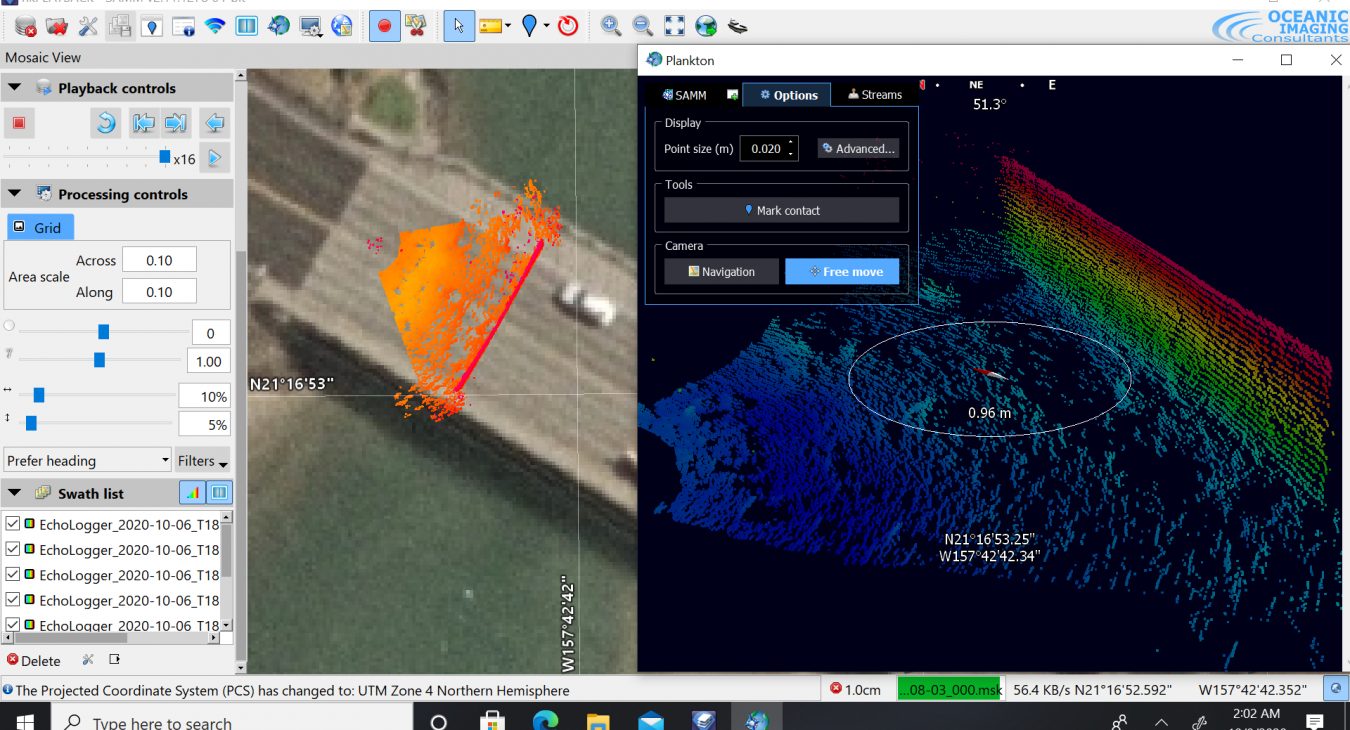
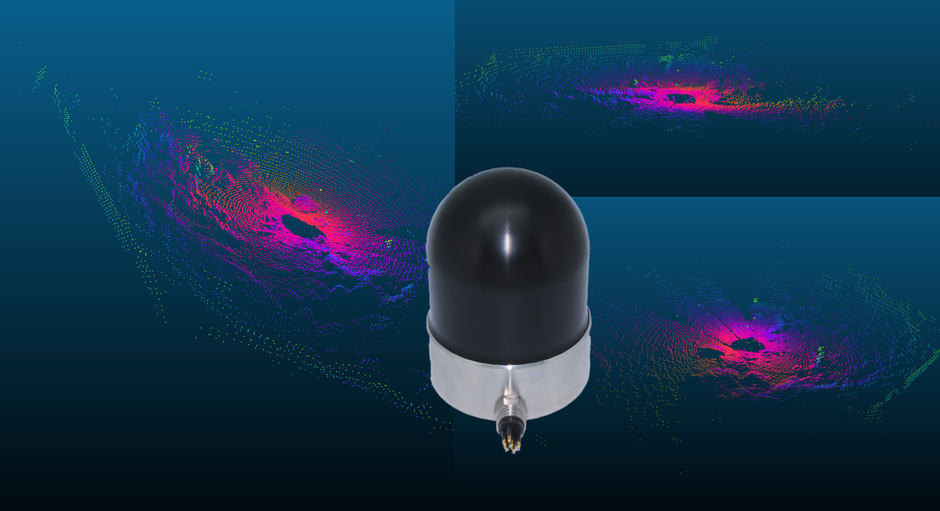
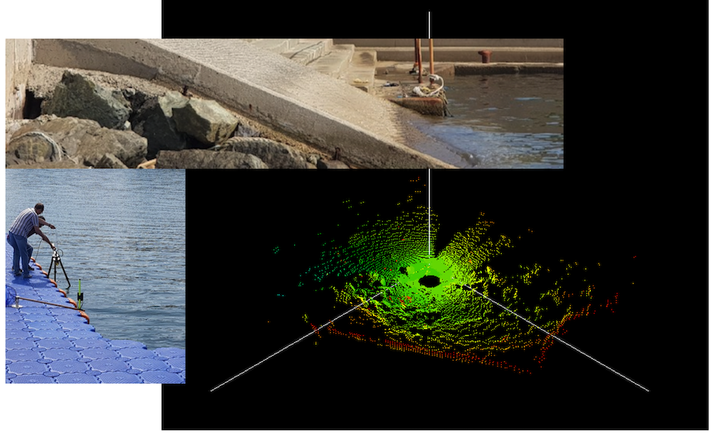
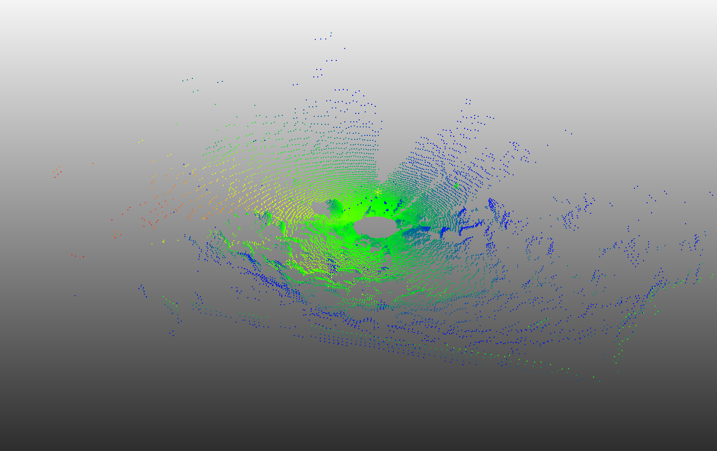
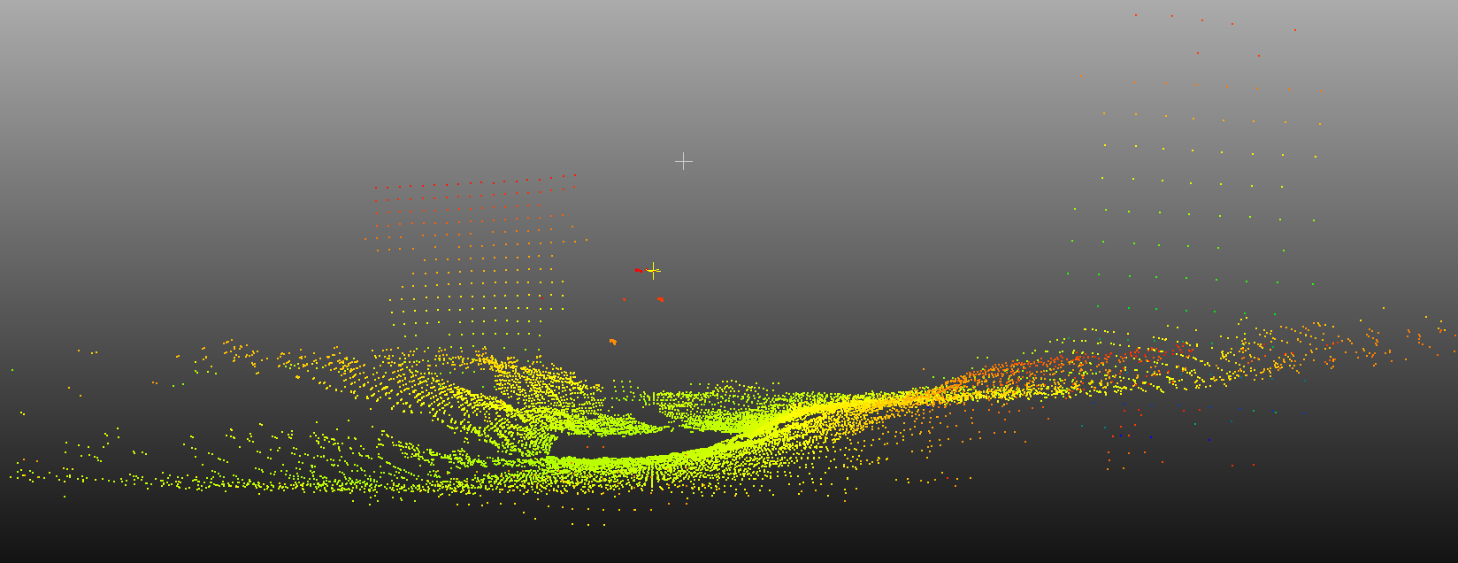
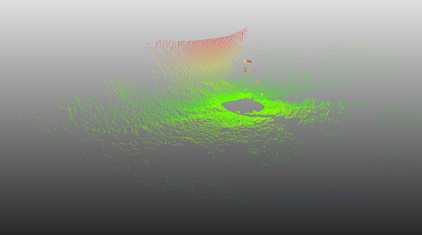
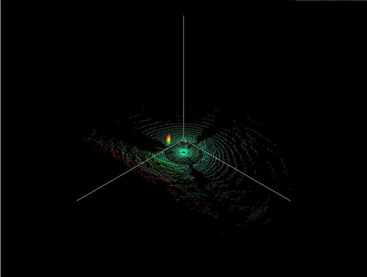
The sonar generates 3D point clouds with exceptional precision, offering a comprehensive representation of underwater structures and dynamics. It achieves meticulous altitude range resolution, capable of detecting changes as small as 1mm, ensuring precision in monitoring underwater features. The scanning precision is adjustable, with an angular resolution as fine as 0.1 degrees, allowing for customized survey configurations.
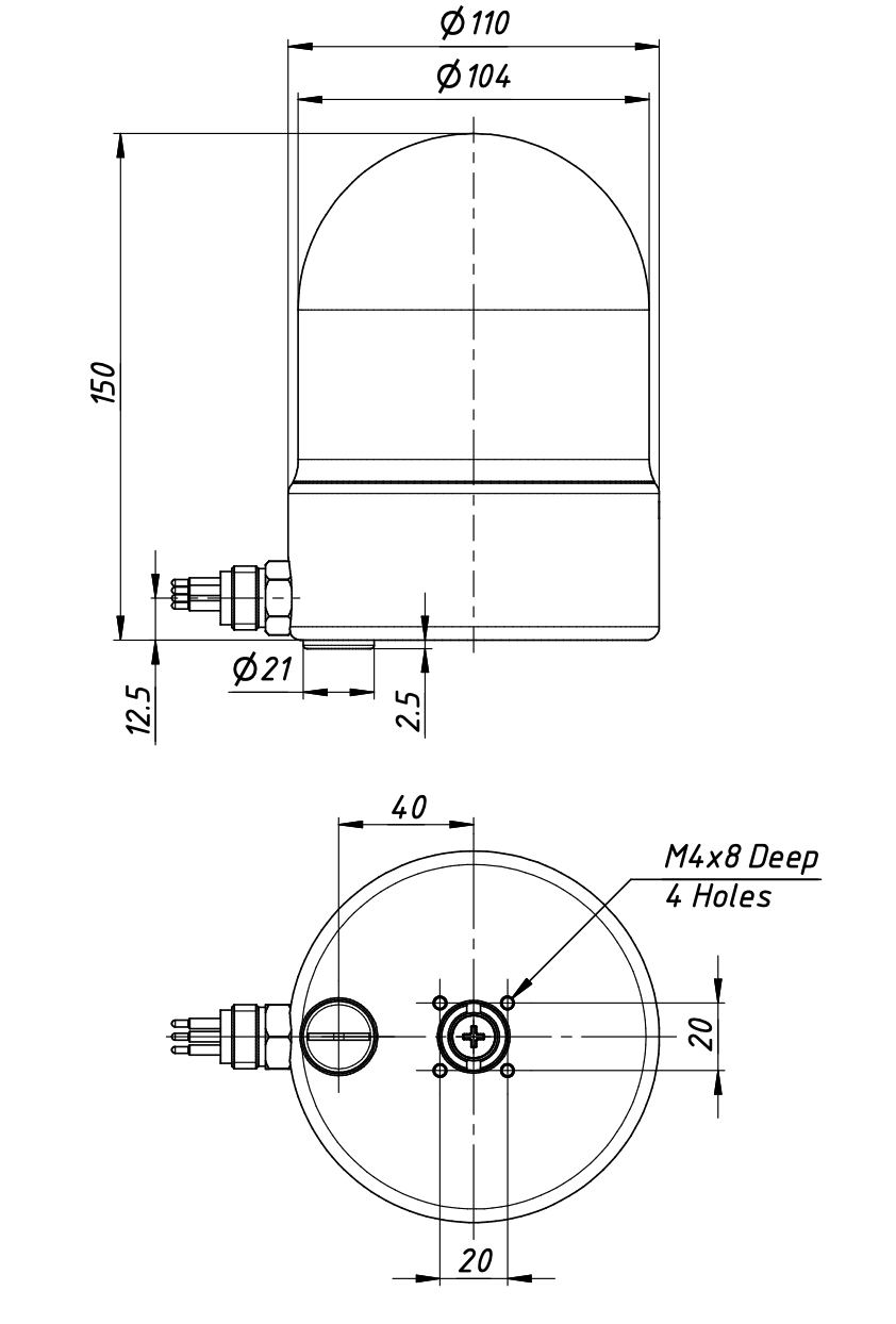
Weighing a mere 2.2kg in air and with dimensions of D110 x H150mm, the DASS710 is exceptionally lightweight and compact, facilitating easy deployment and handling. It offers two deployment modes – standalone deployment for independent surveys or daisy chain mode with an RS-485 network for enhanced capabilities and extended coverage.
The DASS710 seamlessly integrates with various commercial and open-source software packages, including EIVA NaviSuite and Cloud Compare, ensuring compatibility with industry-standard tools for data analysis.
Features
- Ultracompact 3D scanning sonar
- High resolution pencil beams with broadband composite transducer
- Versatile adjustible scanning area (full or sector scan) : 360 deg(H) x 200 deg(V)
- Point cloud
- Altitude range resolution : 1mm
- Scanning angular resolution adjustable from 0.1deg
- Backscatter data can be collected (option)
- Compatible with EIVA NaviScan and Cloud Compare
- Weight : 2.2kg in air
- Dimension : D110 x H150


| Acoustic Frequency | 750 kHz / 1MHz |
| Beam width | 1.5 ° / 1° Conical (-3dB, echo mode) |
| Max Ranges | 50m/25m |
| Scan Angle Resolution | Up to 0.1° |
| Horizontal Scanning Sector | 360° |
| Vertical Scanning Sector | 200° (±100°) |
| Range Resolution | 1.0 mm |
| Synchronization | Outward / Inward (S/W selectable) |
| Digital Output Interface | RS-232, RS-485 isolated |
| Communication Speed | 4800 ~ 921,600 baud (115,200 baud default) |
| Connector | MCBH6MSS |
| Power supply | 10 ~ 60 VDC, 8W max |
| Operation Temperature | -10°C ~ +50°C |
| Operating Depth | 300m |
| Dimensions | Ø110 x H150 mm |
| Weight | 2.25kg / 0.78kg (air/ water) |
| Housing Materials | SS and Acetal |
What is the DASS710 designed for?
The DASS710 is an ultra-compact real-time 3D scanning sonar designed for generating three-dimensional acoustic representations of underwater structures and terrain.
Typical applications include:
- underwater structure inspection
- scour monitoring
- subsea asset inspection
- bathymetric / geometric modelling
- volumetric change monitoring
How does the DASS710 generate 3D sonar data?
The DASS710 uses a dual-axis scanning mechanism to sweep the sonar beam in both horizontal and vertical directions.
This allows the system to generate:
- 3D point clouds
- volumetric acoustic reconstructions
- multi-angle structural datasets
Unlike standard 2D scanning sonar, the DASS710 captures spatial information in three dimensions.
How does it differ from standard scanning sonar?
Standard scanning sonar provides 2D acoustic imagery in a single scan plane.
The DASS710 adds a second scanning axis, enabling:
- true 3D structural reconstruction
- volumetric inspection
- geometry measurement from multiple angles
- improved interpretation of complex structures
What applications benefit most from 3D sonar?
3D scanning sonar is particularly valuable when users need:
- structural geometry rather than simple detection
- repeatable 3D inspection datasets
- scour / erosion quantification
- inspection of complex underwater infrastructure
- digital twin / modelling workflows
Does the DASS710 work best in static or moving operation?
Does the DASS710 work best in static or moving operation?
The DASS710 performs best in static or near-static deployments.
Because 3D data is built up progressively through mechanical scanning, best results are achieved when:
- the sonar platform remains stationary
- the target remains stationary
- environmental movement is minimised during scanning
It is optimised for inspection and monitoring, rather than fast dynamic survey operations.
How long does a 3D scan take?
3D scan time is significantly slower than multibeam sonar systems because the DASS710 acquires data mechanically over time.
Actual scan duration depends on:
- scan interval settings
- scan range
- angular resolution
- baud rate / communication speed
- selected scan sector
This allows users to trade off between scan speed and data density depending on the application.
Why choose DASS710 over multibeam sonar for 3D inspection?
The DASS710 offers several advantages for close-range structural inspection:
- significantly smaller and lighter than typical multibeam systems
- lower power consumption
- easier integration on compact ROVs
- more cost-effective for fixed / repeatable inspection tasks
- optimised for high-resolution local 3D scanning rather than wide-area survey
What sensors are included?
The DASS710 includes onboard orientation sensors to support 3D point-cloud generation:
- Tilt Sensor (standard)
- Compass (standard)
- IMU (optional)
These sensors assist with scan orientation and spatial reconstruction.
What acoustic performance does the DASS710 provide?
Typical specifications include:
- Operating Frequencies: 750 kHz / 1000 kHz
- Very short minimum range for close inspection applications
- High-resolution beam suitable for detailed structural scanning
The dual-frequency design allows optimisation for range versus resolution depending on the target environment.
Does the DASS710 generate true 3D point-cloud data?
Yes. The DASS710 generates true 3D point-cloud data from its dual-axis scanning process.
This enables users to:
- visualise underwater structures in three dimensions
- measure geometry and spatial relationships
- compare repeat scans over time
- integrate sonar data into modelling / inspection workflows
The generated 3D data can be viewed and analysed using standard point-cloud viewing software.
What interfaces does the system support?
The DASS710 supports:
- Serial communication interfaces for system integration
- Developer/API integration for OEM applications
For Ethernet-based systems, integration can be achieved via Echologger's TU-E2S Ethernet Converter, enabling network-based deployment.
- Log in to post comments